
Clay County ZIP Code Coverage
Clay County's 2024 budget lists 28 ZIP codes that serve some part of the county. That is a county-service list, not a parcel-by-parcel delivery map. The table keeps the research distinction intact: a named post office association appears only where the source verified one; the remaining entries need an address check. Several 641-series ZIP codes are Kansas City metropolitan postal geography and can cross city or county lines.
| ZIP | Areas Covered | Post Office | Notes |
|---|---|---|---|
| 64024 | Excelsior Springs city and county use | Excelsior Springs | USPS location association verified |
| 64048 | Clay County coverage listed | Not separately verified | Check the delivery address |
| 64050 | Independence-area postal geography | Not separately verified | Do not assume a county or city boundary |
| 64053 | Kansas City and Independence postal geography | Not separately verified | Exact Clay parcels were not mapped |
| 64058 | Excelsior Springs-area postal geography | Not separately verified | Check the exact address |
| 64060 | Kearney anchor ZIP | Kearney | Post office association verified |
| 64062 | Clay County coverage listed | Not separately verified | Use USPS address lookup |
| 64068 | Liberty and county-seat postal area | Liberty | Liberty anchor ZIP |
| 64069 | Liberty postal and rural association | Not separately verified | Do not treat it as a Liberty city limit |
| 64072 | Clay County coverage listed | Not separately verified | Use USPS address lookup |
| 64073 | Clay County coverage listed | Not separately verified | Use USPS address lookup |
| 64077 | Clay County coverage listed | Not separately verified | Use USPS address lookup |
| 64089 | Smithville anchor ZIP | Smithville | Post office association verified |
| 64116 | Kansas City postal area | Not separately verified | Verify the parcel and delivery address |
| 64117 | Kansas City postal area | Not separately verified | Clay County ZIP in the budget list |
| 64118 | Gladstone and Kansas City postal area | Not separately verified | Shared Clay and Platte geography is possible |
| 64119 | Antioch, Gladstone, and Kansas City postal area | Antioch | City line differs from ZIP |
| 64120 | Kansas City postal and industrial area | Not separately verified | Exact Clay service area was not verified |
| 64155 | Kansas City North area | Not separately verified | Clay and Platte geography can overlap |
| 64156 | Kansas City North area | Not separately verified | Check the exact address |
| 64157 | Kansas City North area | Not separately verified | Check the exact address |
| 64158 | Kansas City North area | Not separately verified | Check the exact address |
| 64161 | Worlds of Fun and Kansas City postal area | Worlds of Fun | Postal association, not a city-limit claim |
| 64165 | Kansas City North area | Not separately verified | Check the exact address |
| 64166 | Kansas City North area | Not separately verified | Check the exact address |
| 64167 | Kansas City North area | Not separately verified | Check the exact address |
| 64492 | Trimble postal association | Trimble | County budget list and USPS association |
| 66115 | Kansas ZIP listed in the county budget | Not separately verified | Do not assume Clay parcels without address verification |
The ZIP code directory should narrow a search, not decide jurisdiction. USPS confirms delivery information, while the Clay parcel record, GIS layers, and tax code explain the local government geography behind an address.
Clay County ZIP Code Postal Anchors
Liberty 64068 is a useful county-seat anchor, but it is one part of the county's postal pattern. The research also verified post office associations for Excelsior Springs 64024, Kearney 64060, Smithville 64089, and Trimble 64492. The county includes incorporated communities and unincorporated territory, so a mailing city, ZIP, parcel jurisdiction, and city limit can all differ. That difference is normal in the Kansas City metropolitan edge.
The USPS Liberty Post Office listing anchors the 64068 location shown below.
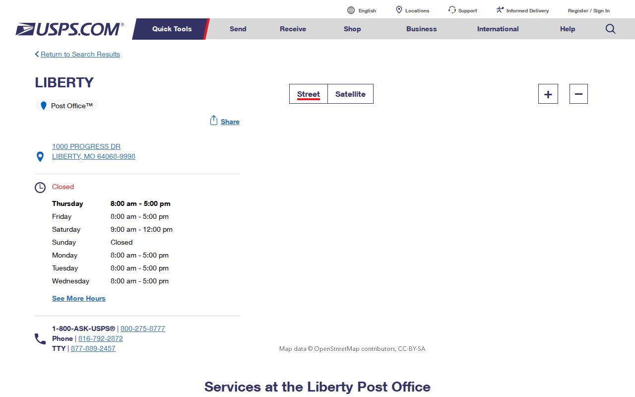
The postal listing identifies a service location. It does not prove a person or company receives mail at every address bearing that ZIP code.
Note: The research did not capture a complete postal-boundary map or a full set of post-office labels for every listed ZIP.
Use a Clay County ZIP Code Filter
A ZIP is a good first filter when the address is known or when several parcels have similar street names. Start with USPS to validate the delivery ZIP for the exact street address. Then use the Collector's address search to narrow tax accounts by ZIP or postal code. The Assessor parcel card can show an owner's mailing ZIP, while its situs address identifies the property itself. Those are different fields and should stay different in a Clay County ZIP code directory search.
- Run the USPS ZIP Lookup by street address and city/state, or use its city/state and ZIP-to-city modes when that is the question.
- Search the Collector by a complete street number or street name, then add city and ZIP or postal code to reduce the result set.
- Open a candidate parcel card and compare the situs, owner, mailing ZIP, parcel identifier, and tax area.
- Check GIS city-limit and taxing-district layers before treating the mailing city or ZIP as a jurisdiction.
When the ZIP has narrowed the area to a particular street, the address-first record chain belongs in the Clay County street directory. A ZIP-wide result does not reveal every resident or settle which people live in a household.
Clay County Collector ZIP Fields
The Clay County Collector search has three practical routes: property account number, owner or business name, and street address. ZIP or Postal Code is an optional field in address mode. The site requires at least four letters or numbers for a street address and at least three characters for a name or business search. Account-number mode expects a 14-digit number. These rules make the ZIP field a useful narrowing tool rather than a way to create a countywide resident list.
| Field label | Type | Required | Options and format |
|---|---|---|---|
| Property Account Number | Text | For account mode | 14 digits; personal-property numbers begin with 000 |
| Last Name or Business | Text | For name mode | At least three letters or numbers |
| First Name | Text | No | Companion filter for name mode |
| Street Address | Text | For address mode | At least four letters or numbers; begin with number or street name |
| City, State/Province, ZIP/Postal Code | Text | No | Optional address-mode refinements |
The tax account can identify a responsible taxpayer, property account, mailing location, or tax status. It does not confirm who occupies the address. For parcel information and the distinction between owner mailing fields and situs, use the Clay County Parcel Search.
Clay County ZIP Growth in Numbers
Clay County's postal spread fits a county that grew from 221,939 people in 2010 to 253,335 in the 2020 Census, with a 2025 estimate of 265,032. Liberty, Kearney, Smithville, Gladstone, Excelsior Springs, Kansas City, and North Kansas City all appear in the county's local context. Growth does not redraw a ZIP boundary by itself, but it explains why a simple town name is often a weak locator.
| Year | Clay County population figure |
|---|---|
| 2010 | 221,939 |
| 2020 Census | 253,335 |
| 2025 estimate | 265,032 |
The Census QuickFacts profile is the source for those countywide figures. They are not ZIP-level population counts; no ZIP-specific population or voter statistics were found in the research.
Clay County ZIP Code City-Line Gaps
ZIP code boundaries are delivery geography. City limits and tax districts are government geography. In Clay County, Kansas City postal ZIPs can touch more than one county, and 64118 can involve Gladstone or Kansas City postal naming with possible Clay and Platte overlap. Liberty 64069 has a PO-box or rural association and should not be used as a city-limit conclusion. The county budget's 66115 entry is another honest warning: a Kansas ZIP can appear in county postal geography without proving that a particular address lies in Clay County.
The Clay County GIS map provides city-limit, parcel, taxing-district, road, and subdivision layers. Its disclaimer says the map is reference material, not a legal boundary determination. Use recorded plats, surveys, and deeds for a legal boundary. No official source located a ZIP split or realignment date, so this ZIP code directory does not claim one.
Boundary check. Confirm a postal address with USPS, then compare the parcel's situs, city-limit layer, and local tax geography before relying on a ZIP.
Clay County Tax Codes Behind a ZIP
Clay County's 24-digit tax code provides a local geography key when the mailing city is unclear. Each pair of digits represents a tax district. The code includes school, city, fire, road, hospital, and additional district pairs. County GIS guidance identifies city-code examples such as Liberty 01, Excelsior Springs 02, Kearney 03, Smithville 05, North Kansas City 07, Gladstone 20, and unincorporated county 29.
A tax code is not a postal route. It helps explain the service districts behind a parcel and is most useful beside the situs address and GIS layers. This prevents a searcher from confusing a postal place name with the local jurisdiction responsible for records or services.
Note: GIS map lines are for public reference and taxing purposes, so use a recorded survey, plat, or deed when a legal boundary is at issue.
Clay County ZIP Code Terms
Postal and parcel records use different vocabulary. Knowing the terms makes a ZIP code directory search less likely to connect the wrong kind of address. A parcel search is keyed to a situs, while USPS is keyed to delivery, and tax correspondence may go to the owner's mailing address. The recorder uses a legal description, not a ZIP, to identify land in a recorded instrument.
- ZIP code
- A USPS delivery area code that can cross city and county boundaries.
- ZIP+4
- An added four-digit delivery segment used for more precise mail sorting.
- PO-box ZIP
- A postal association for box or rural service that does not define a municipal boundary.
- Carrier route
- A delivery sequence used by USPS; it is not a resident roll or property boundary.
- Situs address
- The physical location of the parcel, distinct from an owner's mailing address.